


A little over three weeks ago, in my last blog post, I mentioned that spring has been somewhat normal. But it sure has changed since that time! Do you realize Portland has only seen about a quarter inch of rain in the LAST 3 WEEKS? That’s exceptionally dry.
April rain has swung wildly between wet and dry the last few years. Check out the swing from 2021 to 2022!
This year most of the rain fell in the first week, but since that time I’ve seen the soil around my home steadily dry out. So today I checked the numbers: sure enough, this is just about the driest 3-week period we’ve seen in April. 2021 was similar. Keep in mind our lawns/gardens would like about 1″ of rain each week as temperatures warm into the 60s/70s each day.
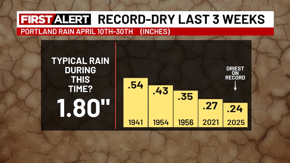
I checked Salem, Hillsboro, Astoria, etc…all stations have been similarly dry. Astoria has only picked up 1/2″ of rain. This has been the case across the PACNW. The last 30 days (after a slightly wet March) have turned very dry
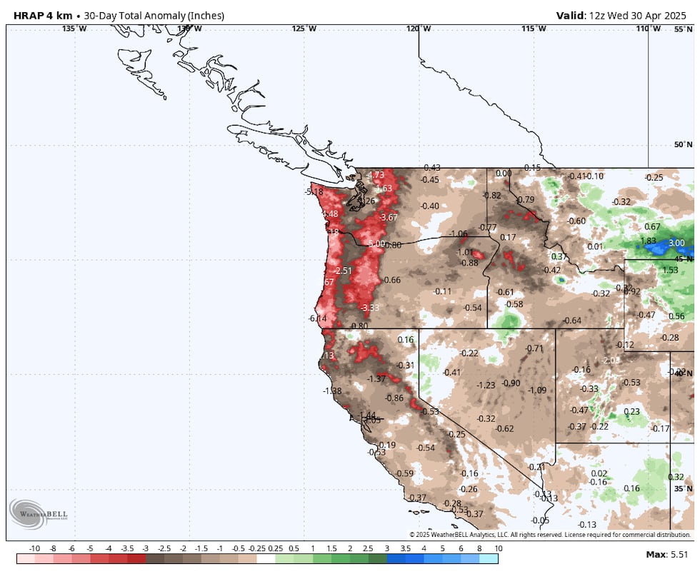
Why so dry? Basically the “polar jet stream” has been farther north than normal, more like what we’d see in June. The 500mb height anomaly shows well-above normal heights over and west of the PACNW the last 30 days

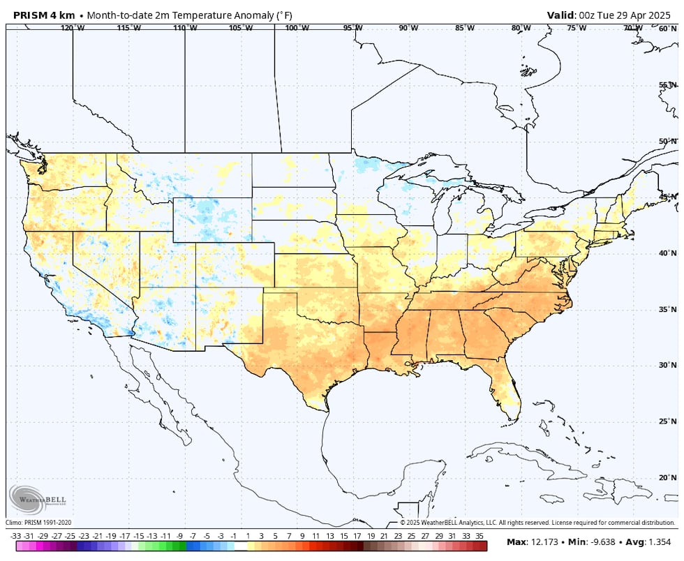
Much of the USA has been (surprise!) warmer than normal this month
SO…YOU SHOULD BEGIN WATERING YOUR PLANTS/YARD AS IF IT’S JUNE
WHAT’S AHEAD?
My gut feeling, after looking over multiple forecast models, is that the warmer/drier than normal spring weather will continue into the first half of May.
We’ve got a summerlike day on tap for May 1st (Thursday). We’ll likely hit 85° at PDX with the “perfect” blend of offshore flow, sunshine, and 850mb temps around +15° (C) in the afternoon. At least we’ll start in the 40s so if you’re frugal like me you can just open windows overnight and in the morning. By 7-8pm it’ll be cooling quickly again.
Here’s the May rainfall over the past few years…not as wide of a variation as April. In fact quite a few dry Mays.
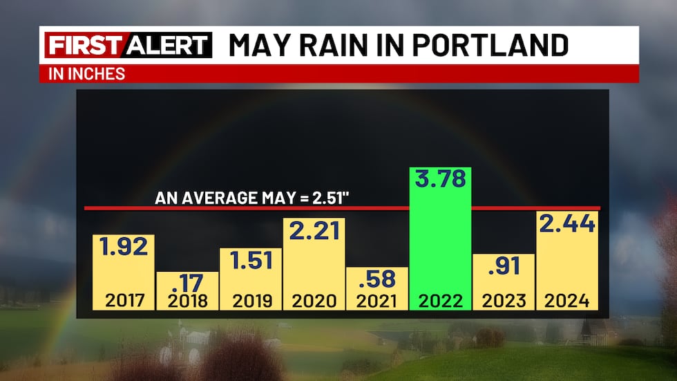
There’s a decent chance you are wondering if this is a long-term trend? It doesn’t appear to be for now. In fact, the 10-30 year average May rainfall in Portland was rising up until just a few years ago. This “drier May” thing is a relatively recent phenomenon; we’ll see if it continues the next 5-10 years.
In the short term, the 500 millibar anomaly for days 6-11 (next week) shows the continued high heights compared to normal (warm colors). This is the ECMWF ensemble average
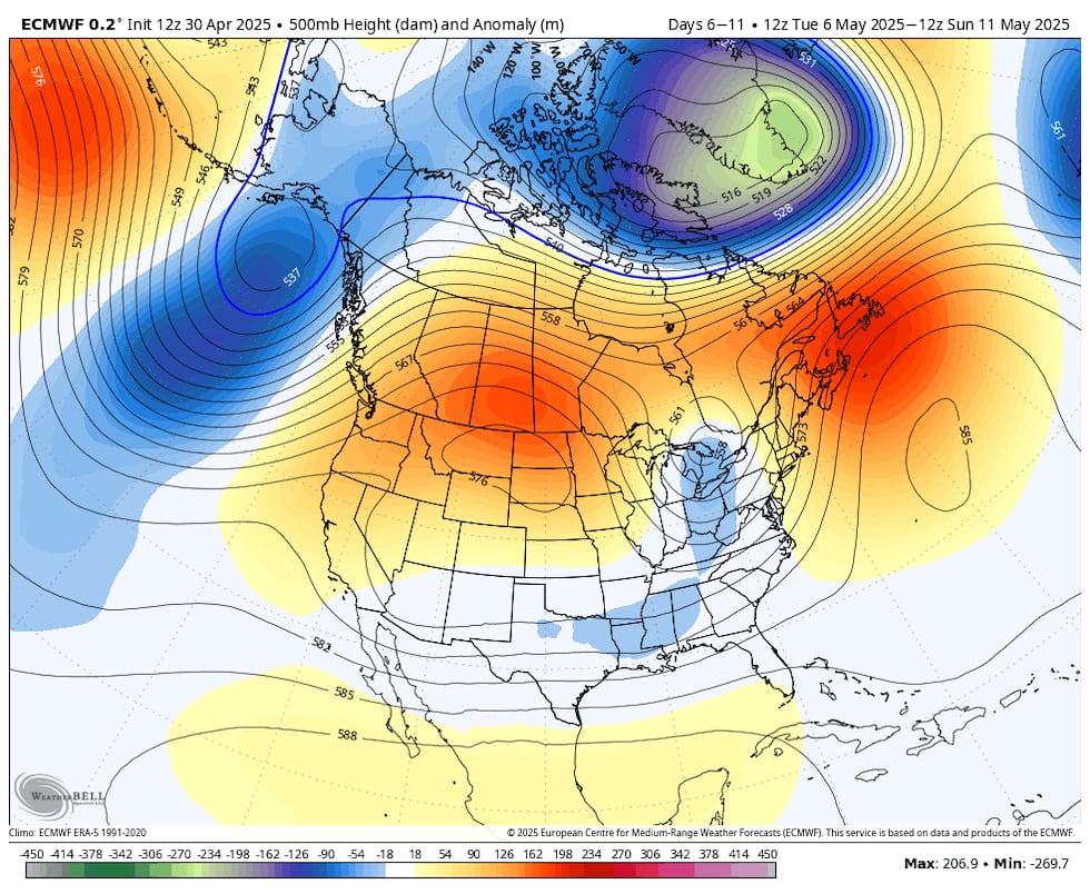
A similar look for days 10-15, which takes us to mid-month

No sign of an upper-level troughing pattern which would give us a week of showers and cool temps. You see the below-normal rainfall pattern along the PACNW coastline over the next 15 days. This is from the A.I. version of the Euro, but other models are similar.
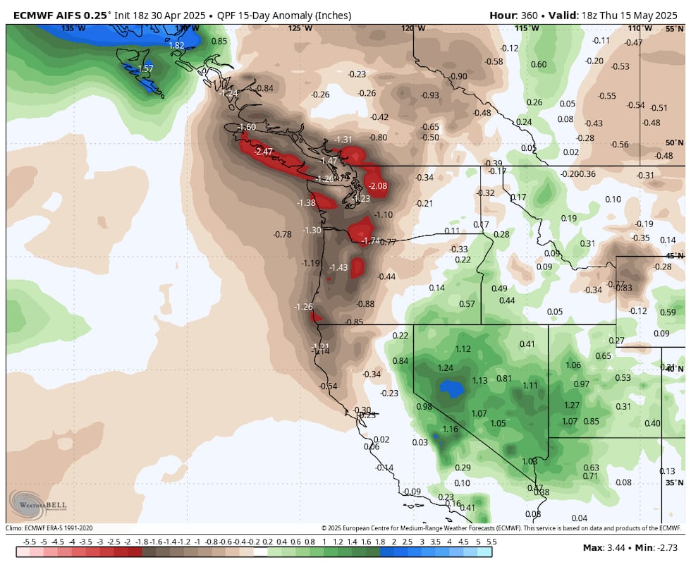
Right now the only chance for showers in the next week or so is Friday evening and early Saturday. Then MAYBE late next week.
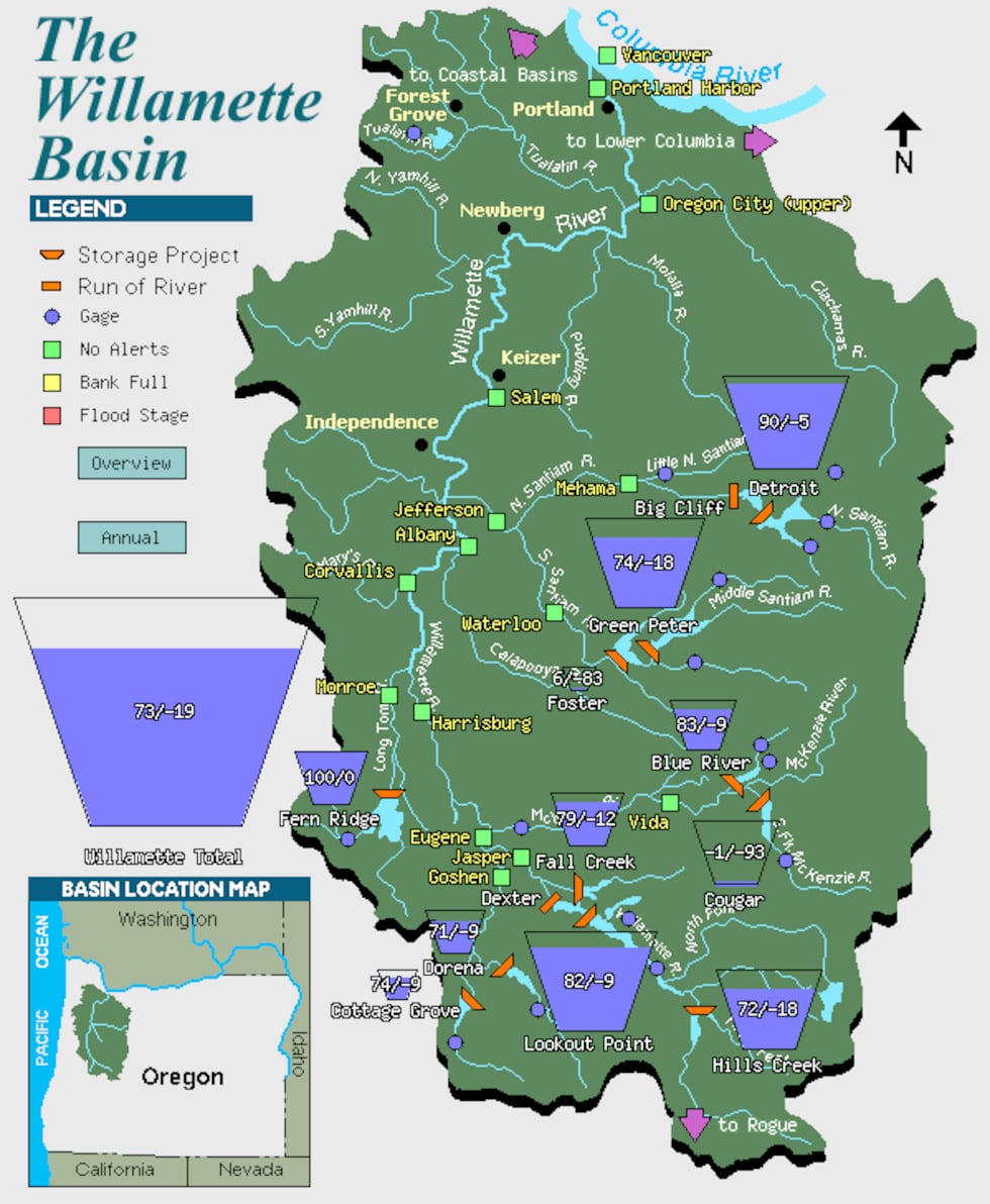
Luckily reservoirs are in good shape across the region due to the abundant winter and early spring snowfall in the mountains. Detroit Lake looks very good for summer fun…
That’s it for this evening.
Copyright 2025 KPTV-KPDX. All rights reserved.


 | Time, TV Channel for WNBA regular season")
